

Land Use and RE Mapping for Cambodia
We are delighted to share the Land Use and RE Mapping for Cambodia report.
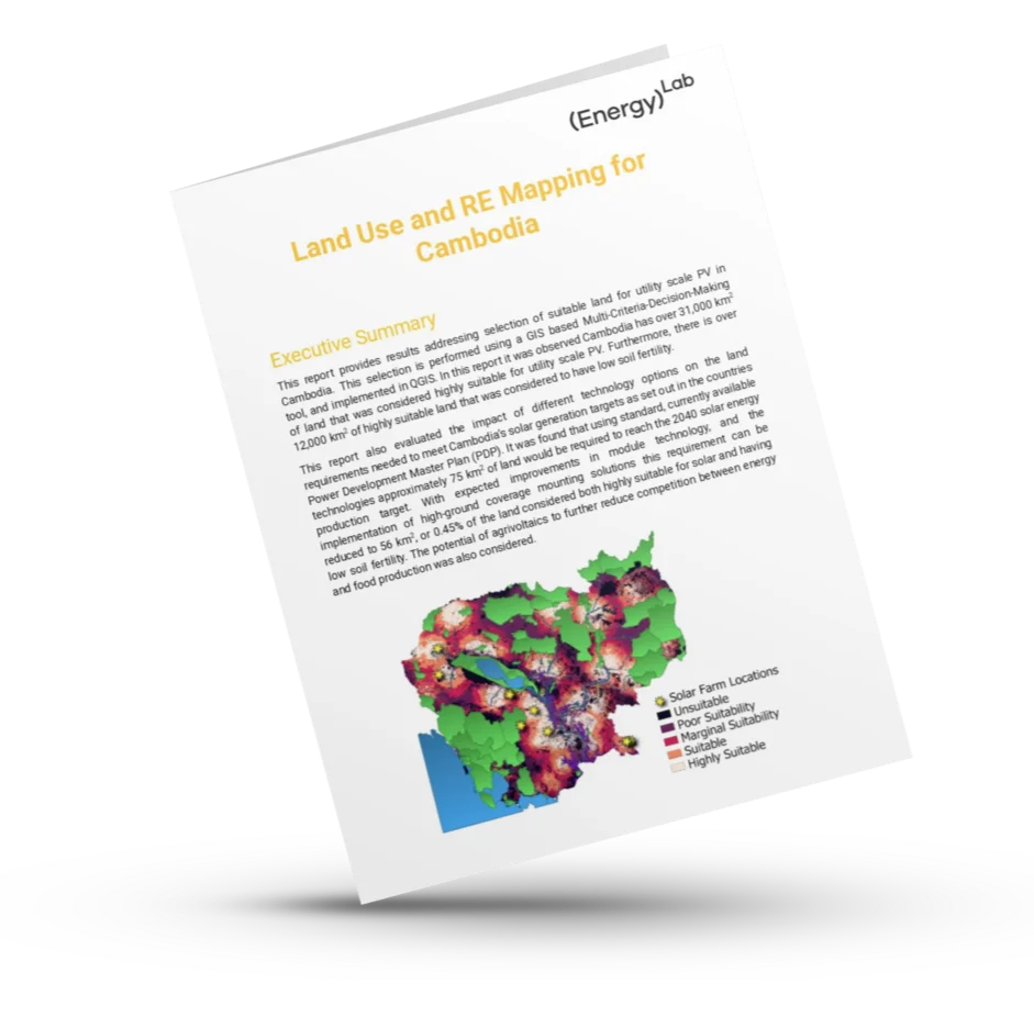
This report identifies over 31,000 km² of highly suitable land for utility-scale solar development in Cambodia using advanced GIS-based analysis. Our findings show that Cambodia can meet its 2040 solar energy targets using just about 75 km² of land and without threatening Cambodia’s food security.
Discover detailed methodology and recommendations for Cambodia’s solar future.
The big insight?
To meet Cambodia’s 2040 national solar generation target, the required footprint is tiny in comparison.
- With standard technology: ~75 km² of land is needed
- With the high-efficiency modules expected in the next 5 years:~59 km²
- With high-ground-coverage east-west systems: just 56 km² -only 0.45% of highly suitable low-fertility land.
That means Cambodia has more than two hundred times the land needed to achieve its 2040 solar target — even before considering agrivoltaics or floating PV.
This underscores Cambodia’s potential as regional renewable energy superpower.
With careful planning, national solar expansion does not need to compromise food production, biodiversity, or sustainable development.
The bottom line? Cambodia doesn’t face a land-availability challenge for solar — we face a coordination challenge. The country has abundant suitable land, a uniform solar resource, and rapidly improving technology. The opportunity ahead is to get the grid infrastructure in place, train the workers we need to deliver the transition and get enabling technologies such as batteries in place.